In today’s construction industry, working with assumptions is no longer acceptable. Projects demand precision, speed, and reliable data, especially when dealing with renovations, infrastructure upgrades, or complex industrial facilities. This is where Reality Capture transforms the way BIM projects are planned and executed.
Reality capture allows teams to digitally record existing site conditions with remarkable accuracy and convert that data into intelligent BIM models. Instead of relying on outdated drawings or manual measurements, project teams can work with real-world data that reflects the site exactly as it exists. When combined with Building Information Modeling, reality capture becomes a powerful tool for reducing risk, improving coordination, and enhancing decision-making across the project lifecycle.
Reality capture is the process of collecting spatial data from physical environments and transforming it into digital information. This data can then be used to create or update BIM models.
It is especially valuable for:
By capturing millions of data points in a short period, reality capture significantly improves accuracy while reducing time spent on manual site surveys.
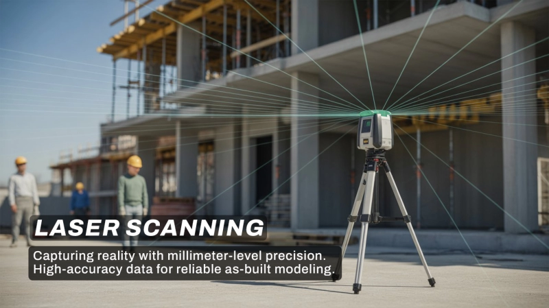
Laser scanning, also known as 3D LiDAR scanning, uses laser pulses to measure distances between the scanner and surrounding surfaces. The scanner rotates and records millions of measurements within minutes, generating highly detailed spatial information.
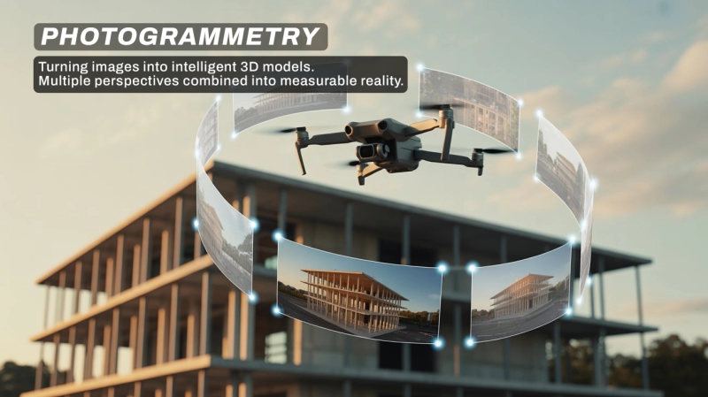
Photogrammetry uses overlapping photographs to generate 3D models. Advanced software analyzes multiple images taken from different angles and reconstructs the environment digitally.
This method is commonly used with drones for:
While it may not always match the micro-level precision of laser scanning for interior details, it is highly efficient for large-scale projects.
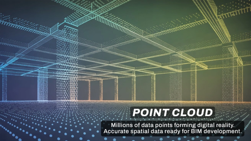
Both laser scanning and photogrammetry generate what is known as a point cloud.
A point cloud is a dense collection of spatial data points, each representing a specific location in 3D space. When visualized together, these points form a digital representation of the real-world environment.
In BIM workflows:
This process is commonly referred to as Scan to BIM.
Scan to BIM involves converting raw point cloud data into structured, parametric BIM components such as walls, floors, beams, pipes, and equipment.
This workflow ensures the digital model reflects actual site conditions, minimizing discrepancies between design and reality.
Advancements in drone technology, AI-driven object recognition, and automated modeling are accelerating the adoption of reality capture. Software tools are increasingly capable of identifying building elements directly from point clouds, reducing manual modeling time.
When combined with digital twins and real-time monitoring systems, reality capture supports smarter asset management and long-term facility performance tracking. This integration represents the future of data-driven construction and infrastructure management.
Conclusion
Reality capture has changed the way the construction industry records and models existing site conditions. By using laser scanning, photogrammetry, and point clouds, BIM professionals can develop highly accurate models based on real data, giving project teams greater confidence in their planning and decision making.
In today’s industry, where accuracy directly affects project cost, safety, and timelines, integrating reality capture with BIM is no longer just an added benefit, it has become a real competitive advantage. For professionals and students who want to build strong skills in this area, practical learning is essential. Anita BIM Solutions is one of the leading BIM institutes in Kerala that provides hands on training and exposure to real projects, helping learners understand these workflows in a practical and industry focused way.